
Flood Plain and River Surveys
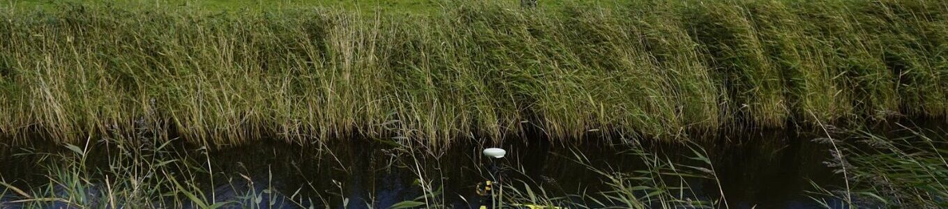
At Merrett Survey, we provide river and floodplain mapping surveys. We use the latest technology including LiDAR airborne and LiDAR terrestrial, drone based aerial mapping as well as mapping on the ground using total stations and GPS. In the image above, an ROV (remotely operated vehicle) is being used to map the river bed using an echosounder.
Using these techniques, we can create detailed maps, river cross sections and profiles. This information is crucial for flood risk assessment and designing effective flood mitigation strategies.
The purpose of river surveys and floodplain mapping
The purpose of a floodplain or river survey is to provide information which helps engineers understand and quantify the potential for flooding. Our survey data is used to inform the design of effective flood defenses like barriers, drainage improvements of property-level-protection (PLP).
Our surveys provide information on a river’s physical characteristics to build hydrological models for flood risk assessment, environmental management, and river restoration. This data includes depth, flow, bed profiles, and surrounding land features, enabling the creation of detailed maps and simulations to inform flood defence, habitat preservation, and infrastructure design.
Flood Risk Surveys For Construction
Moving from understanding flood plain surveys, our focus shifts to examining flood risk surveys specifically tailored for construction projects.
Flood surveys for construction involve assessing the potential flood risks a building may face during its lifespan. By conducting building threshold level surveys, engineers can determine the maximum water levels a structure can withstand before damage occurs. These surveys are crucial for ensuring that construction projects are resilient to flooding events and meet regulatory standards for flood risk management.
Flood Plain Survey Data Delivery
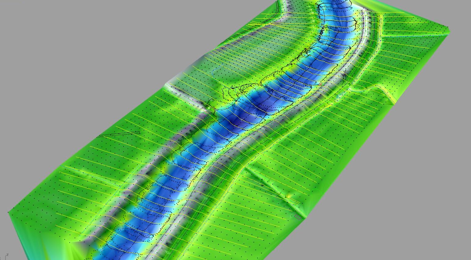
Here at Merrett Survey we offer a range of data delivery processes for flood plain surveys, focusing on:
- Topographical surveys
- Photographic records
- Digital Terrain Models (DTMs)
- We supply data for river modelling in ISIS and EACSD formats
By utilising these methods effectively, we ensure the accurate representation of terrain and river bed features. Merrett Survey have also used dual frequency echosounders to map silt levels which is useful for identifying areas where sediment has built up.
Topographical Surveys
Topographical surveys provide crucial flood plain survey data essential for effective flood risk assessment and management. Aerial topo surveys can measure elevation, contours, and features of the land in flood-prone areas and play a vital role in understanding how water may flow across the terrain during flooding events, helping to identify high-risk zones and potential flood pathways.
By employing advanced technology and accurate data collection methods, topographical surveys enable us to create precise flood risk maps and enhance our ability to predict and mitigate flood impacts.
Through the detailed data delivered by topographical surveys, we can better safeguard communities and properties against the devastating effects of flooding.
Photographic Records
Photographic records can also be used for efficient delivery of flood plain survey data. By capturing detailed images of floodplain section surveys, we enhance our ability to document and communicate crucial information effectively.
Data such as post storm event survey images allow engineers to assess changes in flood extents and understand the impact of flooding on the surveyed areas accurately. These visual records serve as valuable references for analysing flood patterns, identifying vulnerable zones, and aiding in the planning of mitigation strategies.Photographic documentation not only speeds up the data delivery process but also provides a visual narrative that complements the technical data gathered during our surveys.
Coastal Defence Surveys

In the image above, a beach replenishment project is underway. Merrett Survey monitored sand volumes before, during and after this coastal and marine survey project, to ensure that the correct volumes of sand were being deposited and retained (i.e. not carried away by the sea).
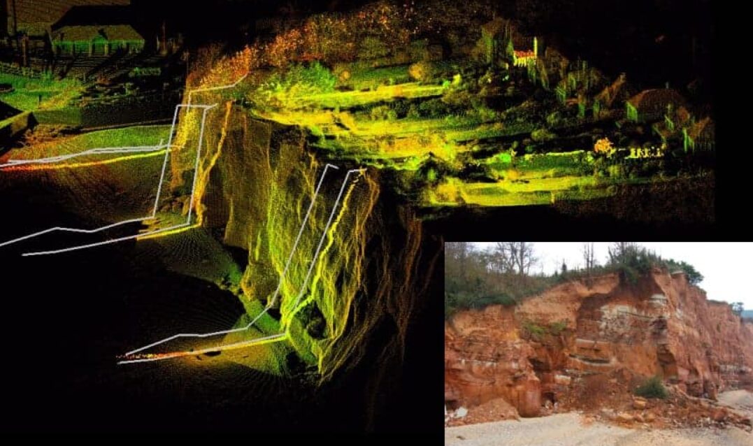
Merrett Survey have also monitored cliffs and sea walls where erosion is taking place, take a look at our coastal topographical and bathymetuc survey services for more information. In the image below, we are monitoring cliff recession in Sidmouth, the white lines show historical data overlaid on the laser scanned point cloud data. We monitor the extent of the cliff recession and the volume of rockfall.

In the aerial image, a new container port is under construction. Merrett Survey provided ae rial imagery and LiDAR surveys of the container port during construction for DP World. We also monitored the extents of the mud flats during construction. This data was used by ecologists.
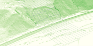
In this image, we can see contours derived from an aerial LiDAR survey, with sections through the cliff face where there had been a land slip. We monitored this slope using terrestrial laser scanning whilst remedial action was taking place.
Contact Merrett Survey for more information on river and floodplain surveys
If you’re looking for specialists to flood plain survey and analysis solutions in the UK or further afield, our team of experts can help. We’ve worked across a number of continents providing stakeholders with essential data and information when in the planning process for potential works. Call our team today on +44(0)1392 362161 or email info@merrettsurvey.com

Peter Merrett - Owner & CEO
Get in Touch


