An aerial survey is used to collect information about the condition of structures and natural elements of the land by using LIDAR and drone equipment.
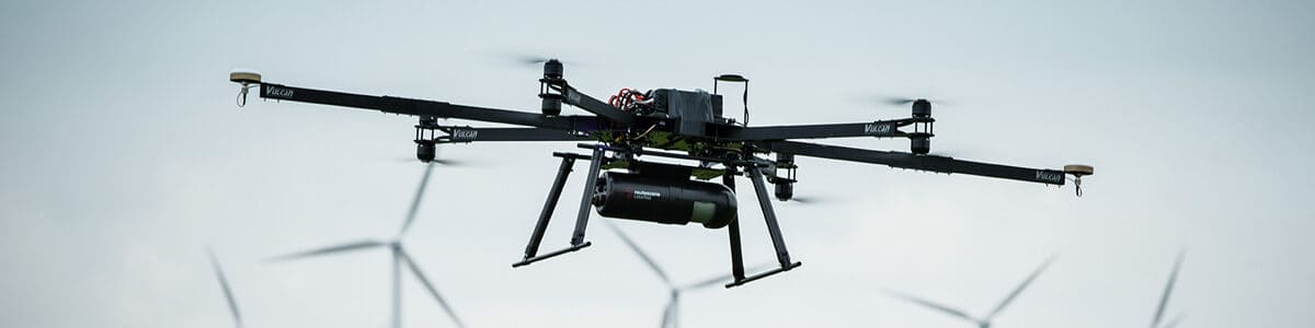
Merrett Survey Limited possess the technology and knowledge to reach even the most inaccessible, inhospitable and dangerous areas. Our honed aerial survey methods enable us to safely assess an area deemed unreachable on foot or by vehicle, providing you with a complete overview of the given area. Whether we use a fixed-wing helicopter or state of the art drone technology, our aerial topographical surveys provide access to difficult places that you require information on. As a team of experienced surveyors who cover multiple disciplines, we have the resources to carry out aerial surveys that capture high-resolution images and detailed survey data.
Through the application of advanced Lidar technology, Merrett Survey Limited provides aerial mapping services. Lidar is a technology that provides us with the ability to present our customers with high accuracy, airborne data acquisition. Our Lidar data is of national and international standards and can have a huge impact on the efficiency and cost-saving elements of a project. Our aerial mapping services, which can be applied to a wide variety of sectors, include:
Note – Lidar mapping can be carried out through the day or at night.
UAV – Unmanned Aerial Vehicles – more commonly referred to as drones.
Our team of professional surveyors are always looking for new, innovative ways to carry out their work and we can now offer the application UAVs or drones for surveying and inspection purposes. The key benefit of using a drone for inspection is the ability to ‘see’ a structure up close without the need for human access. This increases the safety and speed at which the work can be conducted.
We can provide accurate and insightful datasets with a rapid turnaround time. Drone surveys are particularly useful for large-scale sites, where there is a wealth of features to accommodate for and a lot of information to collate. We can mobilise a variety of drones that we utilise for rapid UAV surveys, including a recent addition in the form of the Amalfi Parrot. This has the advantage of a swivel camera that can look upward, so this is ideal for the inspection of the underside of structures (bridges, pontoons, the inside of storage tanks etc).
Whether you require a drone survey and inspection for construction purposes, an aerial survey of a complex plant or an aerial assessment of a rail network, we can help. Contact us if you wish to discuss how an aerial survey can benefit your project.
You can see examples of how we have carried out aerial mapping and survey projects in the past, via our videos section and wider Merrett Survey YouTube channel.
Curious how accurate a drone survey really is, or what one costs? Our team can talk you through both when you get in touch, or read our full breakdown of drone survey accuracy.
See the full case for aerial surveys in land development.
An aerial survey is used to collect information about the condition of structures and natural elements of the land by using LIDAR and drone equipment.
When completing an aerial survey the main technology which is used would be LiDAR which allows for accurate mapping of the area of land and allows for the data to be presented as a 3d or 2d models.
Depending on the size of the land being surveyed, drone and LIDAR surveys can be more efficient than traditional surveying technologies, due to the amount of space they can cover in a small amount of time. Where it might take several man-hours to cover a certain size of ground, a drone is able to cover a large area efficiently.


