Through our experience in producing boundary surveys and border surveys, Peter Merrett felt highly honoured to be invited to tutor at 2 of IBRU’s workshops on International Boundary Demarcation. IBRU is the International Boundary Research Research Unit, based at Durham University. They provide research, consultancy and training to national governments, lawyers and survey departments of many countries around the world – on both land and maritime boundaries.
Our boundary survey services have been called upon by the UN and also national governments, as they looked to professionals who could record to the highest international geodetic standards. Our border survey services have been required between the following countries:
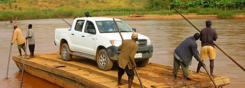
We installed a primary and secondary control network after winning a competitive tender issued by the United Nations. Our network was used by teams of government representatives and surveyors from both countries – the Cameroon Nigeria Mixed Commission (CNMC), to decide and agree and then mark (demarcate) the boundary. Please see our article Merrett Survey Recognised for Nigeria – Cameroon Border Survey Work for more on this.
We provided ground control that enabled an aerial Lidar survey, which was used to determine the watershed (the legal definition of the boundary in a mountainous part of their shared border).
The boundary demarcation had fallen into disrepair and so it was decided to replace existing pillars and install additional ones to better define the border. Included in the border survey was aerial mapping of the border regions. Merrett Survey needed to survey existing evidence of the border and to set out new pillar locations and ensure ‘old’ ones were removed and the new ones placed precisely in the correct location. The new system of markers and pillars was then surveyed and reported in the latest International Terrestrial Reference Frame (ITRF) coordinates.
As a boundary surveying team that has been in the industry for over four decades, we have accumulated a wealth of international experience, having worked across five continents. Please see some more of the international boundary survey work that we have carried out:
Following the Gulf War, some pillars were damaged or had literally ‘fallen’ into disrepair, so a similar exercise to the Kuwait and Saudi border stated above, was undertaken.
This border survey work was a little different in the sense that we were commissioned to install an area-wide DGPS system that UNIFIL forces could use to record any locations that would be agreed in the future, between the 2 countries, along a border that is not currently agreed.
Technically, we won this work from the UN, but hostilities broke out again and our contract never came to fruition. Peace has now returned and we hope one day we can assist with defining and demarcating this boundary.
Geodetic networks – Not all of our geodetic land boundary survey work has been associated with international boundaries. We have completed work on quality control of mapping for the Ordnance Survey and IGN France. In addition to this, we have carried out high accuracy levelling of the benchmark network in Bermuda and the control network in Mauritius.
If you would like to discuss our boundary survey services with our team of experts, please contact us today.

Kuwait – Saudi Arabia boundary survey

Construction of boundary demarcation
pillar – Cameroon / Nigeria border survey

The work involves some interesting access
problems – we go to the remotest locations
