

7 Fascinating Facts About Laser Scanning
The revolution of laser scanning has transformed the way that we capture and analyse data, with the advanced technology producing point clouds that have unparalleled accuracy. This invaluable tool has meant that key industries, such as surveying, can save time and costs, enhancing productivity methods and project effectiveness overall.
At Merrett Survey, we often focus closely on surveying methods and their sole purpose within our industry, however, it is important to also analyse the larger picture and how laser scanning is integrated throughout society.
This blog will explore the evolution of laser scanning, through key facts that showcase the development and growth of the influential laser scanning tool.
1. Laser Scanning Was Invented In The 1960’s
Renowned as the greatest “geospatial leap”, the progressive tool was around during the sixties, however, it didn’t actually make a name for its own within the engineering sector until thirty years later!
Why did laser scanning not advance straight away?
Early laser scanners were large, cumbersome, slow and the results weren’t terribly accurate. The first commercially available terrestrial laser scanner as we know it came in 1991 and was called the Cyrax, which Leica Geosystems would purchase and rebrand as the HDS2400. The first 360 degree terrestrial laser scanner was the HDS3000 released in 2004 – each scan would take 30-40 minutes! Today, full 360 high definition scans can be completed in under a minute.
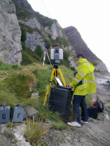
Merrett Survey invested in the Leica Scanstation 2, which came out in 2007 and we have continued to use the latest in laser scanning technology. Our Leica RTC360 can now capture up to 2 million points per second, by way of comparison, the old Scanstation 2 had a maximum scanning rate of 50,000 points per second and needed external car batteries and a laptop! as seen in the image below.
2. Laser Scanning Captures 2 Million Points Per Second
A colossal amount of points are gathered by laser scanning devices in record times, with these 3D survey points rendered as point clouds in specialist software.
This rapid data acquisition is much more effective than traditional methods, which can be significantly time-consuming and prone to human error. Point clouds can be shared easily with our clients for use in programs such as AutoCAD. Merrett Survey also produces 3D BIM models and carries out analysis such as stockpile volumes, structural deformation etc… from the point cloud data.
Reducing on-site survey times by up to 80%, as compared to traditional methods, this speedy tool is just one of many survey methods employed by Merrett Survey. Laser scanning can now be carried out by drone, we also use vehicle mounted scanners and mobile laser scanning technology.

3. Laser Scanning Is Versatile
Enabling a fast, reliable and in-depth survey of structures and their interiors, laser scanning is highly versatile and can be applied across multiple fields, including:
- Architecture
- Construction
- Building Preservation
- Factory Building Design and Planning
- Mining Industry and Tunnel Construction
- Transport: Road, Rail and Highway Surveys
- Deformation Analysis
- Structural Monitoring
- Powerline Inspection Surveys
Why is laser scanning so versatile?
Suitable for all project sectors, including heritage schemes, laser scanning proves its flexibility through being able to provide bespoke, accurate and comprehensive data. It is a rapid, non contact technology that reduces HSE risks, provides detailed documentation and delivers cost and time savings.
4. Laser Scanning and LiDAR Are Widely Used In Other Sectors
The versatility of laser scanning is portrayed through the fact that it is used for so much more than building analysis and application. Laser scanning is being used in computer video games, for example by laser scanning racing circuits, the video game developer can simulate the exact track layout, but also record the bumps for force feedback steering wheels as well as accurately modelling track side detail.
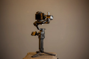
Camera manufacturers are also implementing LiDAR autofocus systems – as found in the DJI Ronin film camera and some Panasonic cameras. Laser scanning of film sets and locations also aids CGI artists and filmmakers.
5. Laser Scanning Can Bring Ancient Times Back to Life
Did you know that many archaeologists can also use 3D laser scanning to analyse historic sites?
Recreating the site, archaeologists are able to bring the site back to life, collecting accurate point cloud data of historic buildings and features.
Having a digital twin of an historical site means that even if a structure is damaged, there is a digital document of it. Apart from digital recording and data dissemination, point cloud data can be used for precise measurements, volume, perimeter and surface area calculations.
Laser scanning can be combined with photogrammetry on historic building surveys to produce heritage standard drawings and models. For a case study, find out more here.
Want to learn more? Check out our whole knowledge section.
6. Laser Scanning Improves Productivity
With the benefits that we have already explored, laser scanning enables individuals to work to a high degree of efficiency. Nowadays, the large point cloud data sets can be viewed and worked on even on a modestly specked laptop, and point cloud data can be shared and accessed online.
Laser Scanning and BIM allows for greater collaboration between different disciplines and ensures that different design teams are all working from one source of ‘truth’. This improved coordination and collaboration prevents costly re-works and clashes on site.
Having an accurate laser scan data set ensures that designers can fabricate elements that will not clash with existing infrastructure. Structures can also be analysed looking for deformation or cracking and subsidence.

7. The Future of Laser Scanning
It is hard to predict the future, but here at Merrett Survey, we see that mobile laser scanning systems which we use for road and rail surveys are becoming more accurate and producing more detail.
Terrestrial laser scanning systems are becoming smaller and easier to use. This miniaturisation may open up new scanning possibilities such as surveying in extremely tight spaces.
Further, we see an increased adoption of cloud based storage and collaboration, enabling us to deliver data to our clients even faster. We see more and more AEC industry professionals using laser scanning due to the high quality of the information delivered.
In the last few years, Merrett Survey have carried out numerous surveys for renovation projects by creating Digital Twins. In scanning existing structures, we are able to produce detailed REVIT BIM models incorporating structural elements and MEP data. These intelligent models are used by engineers and designers to retrofit and refurbish, optimising the construction process and minimising construction errors.
Laser Scanning Surveys At Merrett Survey
As we have investigated, laser scanning is an incredibly powerful tool that is transforming the way that surveyors capture, analyse and visualise data.
At Merrett Survey, we utilise laser scanning across many of our projects, including utilising mobile laser scanners to carry out highway surveys.
We are also using laser scanning in conjunction with photogrammetry so that we get the wonderful imagery combined with the high accuracy laser scan data. Merrett Survey continues to carry out a wide range of building and infrastructure surveys producing BIM models, 3D AutoCAD and MX models.
Find out more about our other case studies.
Book Your Laser Scanning Survey Today
Applying the latest laser scanning methods for over 40 years, our team are experts in laser scanning and have managed laser scanning projects all over the world.
Determine the potential of your project today by contacting our friendly team at Merrett Survey by phoning us on 01392362161. You can also email us on info@merrettsurvey.com and we look forward to hearing from you.

Peter Merrett - Owner & CEO
Get in Touch


