
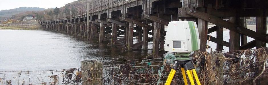
The Latest Developments In Laser Scanning
Utilising laser scanning technologies with diverse sets of functions is pivotal for optimising workflows, creating opportunities to improve efficiency and reducing overall costs. Therefore, choosing the right technologies with the best sets of functions is crucial in geomatics.
At Merrett Survey, we are constantly looking for ways to enhance the efficiency of our laser scanning methods to produce the most accurate results in the most efficient manner. Due to the incredible capability of laser scanning taking 3D measurements, which is ideal for BIM modelling and more, laser scanning systems are able to survey all types of environments. From measured building surveys to road highways and airports, laser scanning is becoming an increasingly important part of the future for surveying.

SAMSUNG CAMERA PICTURES
What Is Laser Scanning?
Laser scanning is an intricate technology that allows surveyors to capture environments in 3D with both enhanced speed and accuracy.
Each surface that the laser scanner comes into contact with is reflected back and recorded as a surface point, before being assigned a colour and surface reflectivity.
Did you know?
Hundreds of millions of data points can be captured in a single session which, when combined, are called a point cloud. The impressive Leica P-Series Laser Scanner captures one million points per second, with a range of more than one kilometre that has 2-4mm accuracy.
What Is LiDAR?
Officially standing for Light Detection and Ranging, LiDAR is a popular remote sensing method that uses light within the form of a laser to measure the time that the lasers take for the reflected light to return to the receiver.
Officially standing for Light Detection and Ranging, LiDAR is a popular remote sensing method that uses light within the form of a laser to measure the time that the lasers take for the reflected light to return to the receiver.
Typically consisting of three instruments; being a laser, scanner and specialised GPS receiver, LiDAR, they work together to gain detailed information of entire rooms, buildings and even cities.
LiDAR can be used as a efficient tool for a range of services, including:
- Collect 3D measurements to create digital terrain (DTM) and digital elevation models (DEMS) of landscapes.
- Tracking building projects and producing digital twins for building information modelling (BIM) applications.
- Mapping the built environment, including buildings, road networks and railways
- Mapping flood risks, carbon stocks in forestry
- Monitoring coastal erosion
- Creating 3D models of mines
- Safely land lunar vehicles on planets from NASA
- And more!
Check out our blog that explores what exactly is LiDAR & how is it used by surveyors in more detail right here.

What Are The Benefits Of Laser Scanning?
The innovation of laser scanning was monumental within the surveying industry. The key benefits of the technology include:
Speed
Scan, capture and analyse data in rapid times.
Accuracy
Capture rapid data acquisition across expansive areas, as compared to traditional scanning methods.
Safety
Difficult to access or perilous geographical areas are easier and safer to navigate thanks to digital camera technology that only requires a touchless measurement. This means that freeform surfaces can be scanned even more accurately and efficiently.
Detailed Information
Less assumptions are made and more truth based assessments are given by the widened data set, avoiding generalisations and errors in interpretation that could sometimes be had. Detailed, precise and intuitive, laser scanning surveys are an exceptional all-rounder.
Coordination
Engineers, architects and construction companies are brought together to ensure spatial coordination and collaboration.
Range of Deliverables
The practical 3D models can be presented in a range of compatible formats available including AutoCAD, Revit, ReCap, BIM and 12D.
As evident from the benefits above, digital methods have transformed construction. With the application of laser scanning technology providing inclusive data sets which clearly define dangerous areas and any potential hazards, all with greater speed, accuracy, and safety, gathering much needed data on prospective worksites and other projects has never been easier.
The Latest Laser Scanning News
As geospatial engineers with over 40 years of experience, the team at Merrett Survey ensure that they keep up to date with the latest technology and advancements within the industry. Why not find out more about our international surveying experience?
Keeping up to date ensures us to stay ahead of the game, incorporating the latest tools and techniques to advance our work even further and provide our clients with the best possible service.
Take a look below to find out more about our latest laser scanning instruments…
Leica RTC360 3D Laser Scanner
With many different technologies on the market, there is a vast range to choose from when thinking about your sector, client needs and specifications. However, the Leica RTC360 is an advanced and highly sophisticated product which ticks all of our boxes.
The 3D laser scanner, complete with HDR spherical imaging system and Visual Inertial System (VIS) allows for real time registration. With its ability to scan large scale areas with immense speed, precision and agility, the RTC360 is the ideal tool to further our laser scanning and LiDAR expertise.
Key benefits of the Leica RTC360:
- Measure the distance to an object two million times per second.
- Automatically remove objects from the collected data with the ‘double scan’ feature
- Complete full dome scans, including High-Dynamic Range (HDR) imagery in under 2 minutes with the RTC360.
- Take multiple images with the rotating camera on this high-tech laser scanner, as each 360 degree ‘bubble image’ is 432 megapixels and has a built-in 36 Megapixel camera.
- Conduct high quality laser scans that are dense in detail and can be used in a variety of applications with low noise data.
- Check your content on site with the Cyclone FIELD 360 software for automated field registration, with the RTC360 providing unmatched precision.
- Enable the augmentation of data, with information tags allowing our team to reflect site reality, illustrate opportunities for better planning and boost situational awareness.
The Future of Laser Scanning For Land Surveys
Speaking of the benefits of the RTC360, owner of Merrett Survey Limited, Peter Merrett stated: “We have a reputation for applying the latest technology in our land surveys, yet we only apply it when it has been proven to bring genuine benefits – either in terms of speed or accuracy and quality of the end product. This instrument certainly speeds up our fieldwork. Plus, on the quality front, the built in HDR camera is of very high quality.
The photographic part of the scan process tends to slow down the scanning work considerably, although, with this laser scanner, the imaging time is only two minutes per set-up. This enables us to colourise the point clouds we produce to a very high standard and also gives the client a greater insight into the structure or asset we are surveying.
The advantages of laser scanning surveys to the construction industry shouldn’t be underestimated, and with technology continually improving year on year, it’s expected that these benefits will only continue to grow”.
Receive Your Free Laser Scanning & LiDAR Quote Today with Merrett Survey
Whether it’s measuring deformations with laser scanning, surveying vast areas of land or even calculating the bundt capacity for storage tank surveys, the RTC360 allows us to deliver fast, pinpoint results.
If you’re interested in finding out more about our laser scanning and LiDAR services in greater detail and would like to discuss the full use of the Leica RTC360, then get in touch with our team today.
Simply contact us by emailing us at info@merrettsurvey.com or phoning us on +44(0)1392 362161 and our team of experts will be able to help you.

Peter Merrett - Owner & CEO
Get in Touch


