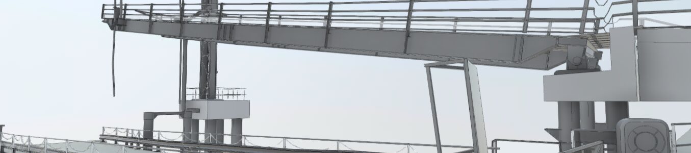
Merrett Survey were commissioned to conduct a hydrographic survey for a ferry terminal in Southampton. The hydrographic survey was carried out to assist the design team, who are working on a project for a replacement Linkspan, maintenance pontoon, access bridge and associated works. The purpose of the hydrographic survey is to allow construction site areas to be planned. The image below shows part of the Revit BIM model that was produced, with the bridge is in its highest position.
We have a great deal of experience conducted coastal & marine hydrographic surveys in and around ferry terminals, ports and harbours, having completed projects in Pembroke, Plymouth, Penzance, Lyme Regis, Jersey and Oman, plus 390 sq km of aerial LiDAR of the Thames Estuary for DP World’s London Gateway.
The work in Southampton was carried out in inclement weather, but we used the Leica P40 laser scanning device, which recorded fantastic results, even in the rain. The high speed scanning also allowed us to work and record detail in narrow time slots in between ferry crossings.
Whilst we specialise in land surveying, we have skills in other survey work on and under the water as well. We surveyed the sub-sea environment using ‘conventional’ echo sounding, multi beam and side scan sonar to map the sea bed, sub-sea walls and piles or columns.

The end result was a topographic survey drawing of the terminal and a highly detailed BIM model of the piers, terminal infrastructure and sea bed.
This work required detailed scanning and modelling of roll-on, roll off (RoRo) ramps and pontoons, quay walls and dock facilities.

Merrett Survey uses cutting-edge building information modelling (BIM), an intelligent 3D modelling process that supports construction projects. Merrett Survey and our BIM experience provides our clients with tools and insights to assist planning, design and engineering decisions
