
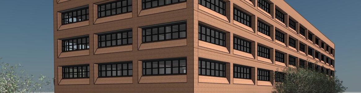
What Is Scan To BIM Within Surveying?
At Merrett Survey, we use the most advanced and up-to-date technology in order to conduct comprehensive and informative surveys for all of our clients. A fundamental method we use is laser scanning, otherwise known as Lidar, where we use a 3D laser scanner to capture the imagery of the site and transform the gathered data into a detailed BIM model, also known as ‘scan to BIM’.
This article will explore what scan to BIM is, how it works and why it is so important within the surveying industry. We will also dive into the advantages and challenges that scan to BIM can raise, how to overcome these issues and the future of BIM within surveying.
What Is Scan To BIM?
Scan to BIM (Building Information Modelling) is a process that involves capturing and converting physical structures into digital models, which can then be used for a variety of purposes. This method highlights the physical and functional characteristics of an asset, such as:
- A building
- Construction projects
- A structure
- Or almost anything else
The data gathered enables us to gain crucial data about the size, shape, distances, directions, angles and elevations of the asset.
Scan to BIM utilises advanced scanning technologies, such as laser scanning and photogrammetry, to collect accurate and detailed data of existing buildings or infrastructure. This data is then used to create three-dimensional models that can be further analysed, visualised, and integrated with other BIM software for use by our clients.
This is why at Merrett Survey, we have over forty years of international experience, where we have applied a large range of technologies, including Lidar throughout the multiple sectors including:
How Is Scan To BIM Used By Surveyors?
Brand new buildings and structures can be modelled into a BIM environment straight from the design drawings, but for refurbishment and repurposing projects, and for heritage buildings, it’s necessary to survey the site using laser scanners in order to create the BIM model. Scan to BIM has become an increasingly popular method for capturing information of structures, as it ultimately provides surveyors and their clients with a precise representation of the existing conditions, which allow for more efficient and accurate design, renovation, and construction processes.
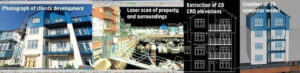
When surveyors carry out the laser scanning to BIM process, this involves the use of the scanner which projects laser beams to measure the distance between the scanner and the object being scanned. These laser beam reflections, combined with knowing the direction and elevation of each beam, is used to create a point cloud, which is a collection of millions of high accuracy 3D coordinated points that represent the surface of the building or structures being surveyed.
By using laser scanners, surveyors can capture millions of data points within a very short period, resulting in highly detailed and comprehensive models. This technology has proven to be particularly useful in complex projects where traditional surveying methods may be time-consuming and less accurate. Moreover, Scan to BIM offers the advantage of reducing human error and minimising the need for manual measurements, leading to improved productivity, safety and cost-effectiveness.
The Importance Of Accuracy In Scan To BIM Surveys
The precise and meticulous capture and modelling of existing structures using advanced laser scanning techniques is crucial in scan to BIM surveys, as it ensures the accuracy and reliability of the resulting three-dimensional point cloud data.
Accuracy assessment in scan to BIM is a vital step in the surveying process, as it allows for the verification of the captured data against the actual physical environment. This assessment involves comparing the point cloud data with the existing structure to identify any discrepancies or errors. By conducting accuracy assessments, surveyors can identify and rectify any issues that may affect the quality and reliability of the BIM model. The point cloud created from each scanner setup is joined together in a process known as Registration.
Advantages Of Scan To BIM
There are many advantages to Scan To BIM, as it is an indispensable tool that is used through an increasing number of surveying projects currently. Here are the main reasons as to why Scan To BIM is a crucial tool for all land surveyors:
- Reduced construction time
- Reduced cost
- Improved safety
- Improved quality of survey
- Allows surveyors to identify any aspects that could interfere with the survey process
As shown above, implementing Scan to BIM surveys has many benefits for surveyors and designers. The accurate capture of existing structures requires a high level of expertise in laser scanning techniques, to ensure comprehensive coverage and equipment selection suitable for each project (considering range, accuracy, ease of use, access etc).
Overcoming Challenges When Implementing Scan To BIM
It can be noted that the large volume of data obtained from the scans can sometimes be overwhelming and time-consuming to process and model, but these ‘problems’ are far outweighed by the advantages it brings.. The importance of accuracy in Scan to BIM surveys cannot be overstated, as even small errors can have significant implications for the design and construction process.
Therefore, precise data acquisition and processing techniques are crucial to ensure the reliability of the resulting 3D models. Fortunately, our specialist survey team is trained in scan to BIM to the highest standard and accuracy.
The Future For Scan To BIM Surveying
Emerging advancements in technology and data processing are revolutionising the field of spatial data analysis and modelling, offering exciting possibilities for the future of scan to BIM applications in the construction industry. As technology continues to evolve, we can expect the following future trends in scan to BIM for surveying:
1. Increased Automation
With the development of artificial intelligence and machine learning algorithms, the process of converting point cloud data into BIM models will become more automated. This means that surveyors will spend less time manually processing data and more time analysing and interpreting the results.
2. Integration with Other Technologies
Scan to BIM for surveying is already being integrated with other technologies such as augmented reality (AR) and virtual reality (VR). This integration will allow stakeholders to visualise and interact with BIM models in a more immersive and intuitive way, improving communication and decision-making processes.
Many people in the built environment industry have not yet adopted all of the advantages that BIM can bring and we are then required to generate 2D drawings of floor plans and building elevations. But there is steady progress to adopt Scan to BIM.
Overall
Overall, the future of scan to BIM for surveying looks promising, with advancements in technology and data processing offering exciting possibilities for increased automation, integration with other technologies, real-time data processing, and enhanced accuracy and precision. These future trends have the potential to streamline workflows, improve communication, and ultimately lead to more efficient and sustainable construction practices.
Scan to BIM has revolutionised the field of surveying by allowing for the creation of highly accurate and detailed 3D models of existing structures in shorter timescales. This technology has become an essential tool for various real-life survey applications, including architectural design, construction planning, building maintenance and heritage preservation.
Scan to BIM By Merrett Survey
At Merrett Survey, scan to BIM is a highly valuable tool for providing us with the most detailed and accurate surveys for our clients. Due to the high levels of precision and reliability that Scan to BIM provides, we are able to provide first-class surveys worldwide for any project at all.
If you would like to learn more about Scan to BIM surveys, then please contact us or phone us now on 01392 362161 where we will be happy to discuss this further.
Why Not Have A Read Of Our Similar Blogs?

Peter Merrett - Owner & CEO
Get in Touch


