
At Merrett Survey Limited, we are committed to using the latest and best technology and techniques. One way in which we achieve this is through our point cloud laser scanning surveys. Using point cloud laser scanning technology in our topo surveys allows us to deliver highly accurate data to our clients, no matter what project they’re working on.
However, although we’ve mentioned our laser scanning surveys many times previously, we have yet to outline exactly what point cloud laser scanning involves. So, in this article, we explain exactly how point cloud laser scanning surveys work and what advantages they have over other topo survey methods.
Many industry professionals are aware how important point cloud laser scanning surveys are in a variety of sectors. In the past, we even prepared a detailed article on the advantages of a laser scanning survey to the construction industry; as but one example. However, surprisingly few people outside of topo survey professionals actually understand what these are and how they work.

This is likely the term that trips people up the most. Put simply, the point cloud is a collection of 3D data points that have been measured and recorded to a very high accuracy. The laser scanning instrument ‘scans’ back and forth across an area, an object, a building, in fact almost anything you wish, with up to 1 million measurement points taken per second.
This creates a point ‘cloud’ of three dimensional data, which can then be presented in a variety of data formats. The operation of the laser scanner itself is detailed below.
When point cloud laser scanning is conducted for say, a measured building survey, the millions of data points that are collected, will include all objects & structures in the building such as windows, walls, equipment, doors, steel structures etc. Each data point is plotted along the x, y, and z coordinates within the scanned three dimensional space.
Once this raw data has been collected, an experienced topographical surveyor must then compile these scans into a cohesive point cloud, which can then be used for measuring and modelling to assist with the project at hand. Done properly, this can result in providing measurements accurate to millimetre precision. Some laser scanners are available that work to sub-millimetre accuracies. After the point cloud has been created, it can then be fed into BIM software to provide a full, digitised representation of the building or site, which then provides a method of 3D visualisation of the existing building (or structure). This can aid the design of alterations, monitor changes, measure movement and more – see the benefits listed below.
To the right, you can see an example of a digital model Merrett Surveys developed as part of a point cloud laser scanning survey on a previous project for the redesign of a hospital:
Before a point cloud can be constructed, the data points must first be gathered with laser scanning equipment. This equipment produces a light wave, or laser, which reflects off of surfaces and back to a sensor. The sensor calculates the distance between itself and the surface by measuring the time taken for the light wave to return. The scanner also measures the direction and angle of the laser, and thus calculates the 3D coordinates of the point the beam was reflected from
The laser scanner is moved around the site, so that the surfaces of the structure or building are viewed and scanned from all sides. The ‘point clouds’ created from each scan position are joined together in a process known as registration, to form one much larger point cloud dataset.
The scan data can be coloured using imagery from a camera built into the scanner. Or it can be artificially coloured using the reflectivity (or intensity) of the surface that the laser beam returned from. The image of laser scan data above is coloured by intensity.
This process occurs nearly a million times a second during a laser scanning survey to provide enough data points to produce a point cloud and eventual creation of a building information model (BIM).
The introduction of point cloud laser scanning technology to the topo survey industry was a considerable innovation, offering numerous benefits compared to traditional surveying methods. Some of the top advantages point cloud laser scanning offer are:
Buildings or structures with complicated designs are a prime candidate for a point cloud laser scanning survey. The amount of data on this type of topo survey allows for small details and complexities to be recorded that may not be possible with other methods. An example of this principle in action is our case study on our heritage survey of Redruth Brewery, where laser scanning revealed the full irregularities of the historic structure.
We have used laser scanning to survey many sites and structures including: Cliffs, bridges, oil and gas storage tanks, buildings, chimneys, caves , quarries and mines, stockpiles, culverts, shafts, manholes, vehicles, ships, trees, ports and harbours, inter-tidal zones, railways, complex plant such as power stations, transmission line towers, substations and more.

Highways can pose a particular challenge for topographical surveyors. Local authorities are often not willing or able to close the road or reduce traffic for a long period of time, so a topo survey of any kind must be conducted quickly. Point cloud laser scanning significantly reduces the turnaround time for a terrestrial survey, allowing a wealth of data to be delivered within even a limited timeframe.
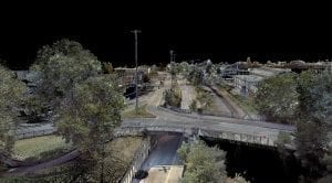
Complex plants & utility structures can be surveyed much more safely using point cloud laser scanning techniques. Data can be collected from the periphery of the site and, if used in conjunction with aerial survey methods, this means accurate data can be collected without risk to the surveyor.

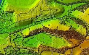
The mining & quarrying industry has long benefitted from point cloud laser scanning technology. This kind of topo survey can aid greatly with exploration, the development of infrastructure, and in measuring stockpile volumes. To learn more about our mining survey expertise, consider visiting our specialised mining surveys website.
At Merrett Survey Limited, our team of expert topographical surveyors are committed to providing you with the most accurate and detailed data possible for your next project. Whether you are in need of a boundary survey, a bathymetric survey, or anything in between, our team of professionals would be happy to hear from you.
Contact us on +44(0)1392 362161 or by email at info@merrettsurvey.com. One of our team members would be happy to answer any questions you may have about our services and if desired, provide a free quote for your next project.
