
The Role of Power Line Surveys in Ensuring Reliable Electricity Distribution
Merrett Survey’s substation and transmission power line surveys aid service providers in ensuring the reliable distribution of electricity to end users. We provide both ground based laser scanning and aerial mapping surveys for all utilities, including LiDAR UAS or helicopter based powerline inspection and mapping surveys.
Vegetation Infringement
A powerline mapping service from Merrett Survey can be essential in identifying and resolving any potential infringements. We survey the catenaries and record vegetation and buildings to maintain required clearances. Our surveys record trees and other features which may infringe upon the conductors.
Merrett Survey uses remote sensing technology such as aerial LiDAR, UAS drone or ground based laser scanning for determining the relative distance between powerline conductors and nearby trees. This approach provides a rigorous, scientific evaluation of how close they are (to prevent a flashover) and whether there is a risk of a tree falling onto the line.
Safety First
Merrett Survey is committed to ensuring a safe working environment and all our surveyors hold a BESC safety certificate. Our drone operators hold a CAA approved A2 CofC and a level 4 drone training qualification, which is an Ofqual-regulated version of the GVC (General Visual Line of Sight) Course.
Our remote sensing surveys reduce risk. The ability to identify bolt centres and measure the length of steel members without the need to climb the towers have provided our clients with time and cost savings.
Our survey data is used by Powerline operators to make decisions about maintenance, repair and upgrades. We provide ground based mapping surveys as well as drone based optical inspection surveys that can aid in identifying defects.
The regular inspection of power lines is important to ensure the reliability of our electrical grid, enabling the transmission of electricity with no losses to increase its longevity and prevent outages. This can majorly disrupt communications, water and transportation, as well as affecting the process of the majority of other retail businesses.
Case Study: Tractor Strike
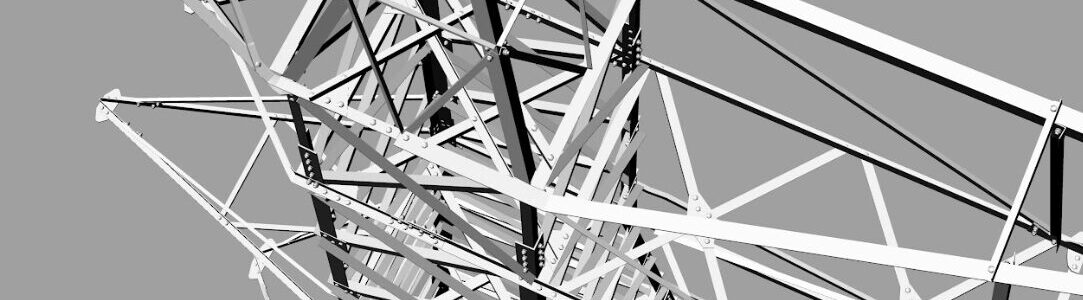
Merrett Survey recently surveyed a pylon that had been struck by a tractor. The electricity tower was damaged and a decision was needed to ascertain if it was still structurally sound. Our laser scanning team surveyed the tower and produced precise and accurate data to inform engineering decisions. In addition, detailed imagery of terminal towers for asset management and maintenance ensures smooth operations of powerline infrastructure.
Our remote sensing surveys provide highly accurate data, and we regularly carry out surveys of infrastructure in remote areas. The rich LiDAR data sets inform better decision making and planning and a remote sensing survey reduces health and safety risks associated with climbing a tower to inspect it.
Our bespoke software and hardware ensures that data collection is rapid and processing and interpretation of the data is fast.. Detailed imagery and PLS CADD models speed up decision making and action.
Case Study: Engineering drawings
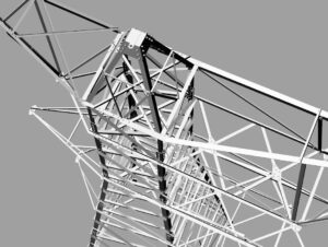
Merrett Survey laser scanned a transmission tower using a high accuracy leica P40 laser scanner. Once the point cloud was registered, we produced detailed AutoCAD drawings and a 3D PLS CADD model. Re-engineering – we can provide engineering drawings of existing towers and critical dimensions for when drawings are lost or incomplete. Further towers on this line were surveyed for critical dimensions, including establishing bolt to bolt dimensions.
Analysis and Outputs
- Merrett Survey provides PLS CADD data for thermal uprating of transmission lines. Outputs include LAS files, AutoCAD DWG and DXF data, ASCII data, XLS spreadsheets, REVIT BIM models, IFC, OBJ, and many more formats!
- Tower verticality and deformation reporting.
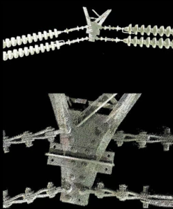
- Our survey data can be used for when conductor and/or insulator replacement is required.
- Asset management – for GIS input. Our surveys record all salient information for powerline operators.
- 3D modelling of the towers and catenaries and the surrounding environment.This data can be imported into PLS CADD or used in a GIS.
- Topographic mapping of the powerline corridor – for new build and re-alignments.
- Sub- stations for download infringements, safety planning of clearances between plant and new installation.
- Data loads directly into PLS-CADD – and is applicable to transmission and distribution powerline networks.
- Emergency and maintenance access planning.
- 360 degree photography of access routes.
Merrett Survey can provide 360 degree panoramic images of the towers and terrain for integration into a GIS. This can be used for access route planning and documentation.
Merrett Survey Limited uses the latest in scanning technology. We have dazzled clients with the speed of data capture and impressed with the accuracy of the data acquired.
Our Power Line Clients at Merrett Survey
As experts in power line surveys, our close-knit team has a significant amount of international surveying experience, where we have worked with large electric grid companies all over the world. This includes:
- National Grid
- EDF
- SSE
- WPD
- EON
- Scottish Power
- RWE NPower
- Babcock
- Mott MacDonald
- Suez
- Edra Energy
Book Your Power Line Survey at Merrett Survey Today
As leading survey specialists, why not start your power line survey journey today? If you’re interested in finding out more, then contact us by giving our friendly team a call on +44(0)1392 362161 or emailing us at info@merrettsurvey.com and we look forward to hearing from you.

Peter Merrett - Owner & CEO
Get in Touch


