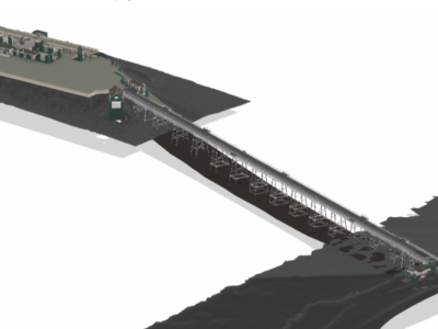
Merrett Survey were commissioned by North Somerset Council and the RNLI to laser scan Birnbeck Pier and Island in Weston-super-Mare.
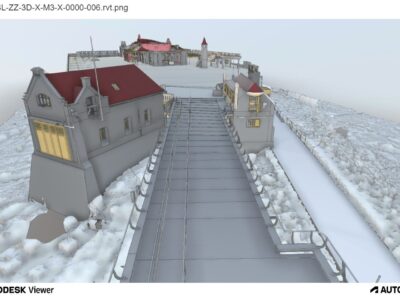
We issued point cloud data, a BIM model and highly detailed elevations, sections and floor plans as well as detailed photogrammetry.
The data is being used as part of a plan to restore the site, which you can read about here.
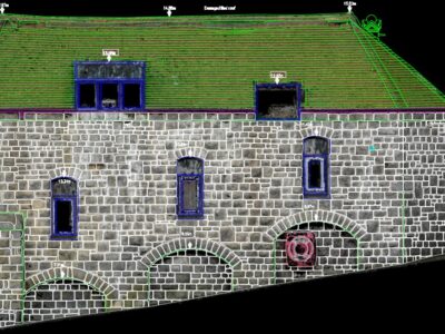
Detailed AutoCAD drawings were issued, detailing every stone and brick as shown in the article. Remote measurement of historic buildings and structures using the technology of terrestrial laser scanning (TLS) and photogrammetry is becoming a more and more popular approach for conducting inventory activities, documentation and conservation works.
The far left image below shows part of the BIM model, which was a challenge due to the dilapidated nature of the structures. The buildings were surveyed inside and out, with the second image below showing the external elevation of the 1888 boathouse on the island. The third and fourth images show one of our surveyors on a boat towards the pier, with the final image highlighting the BIM model that we created.
Our team of geospatial experts have conducted advanced BIM and laser scanning surveys all over the world, with international surveying experience that spans across Europe, Africa, and further. Start visualising the end result by contacting us to receive your bespoke BIM consultation.