
You might be forgiven for thinking that topographical surveys are limited to solid ground – they are often referred to as land surveys after all. However, at Merrett Survey Limited, we are anything but. As such, we do not constrain our expertise to only conducting topo surveys on land, but extend our services to the sea bed as well.
However, there is a great deal of confusion as to what a bathymetric survey involves, let alone how it is performed. As such, in this article we break down all that you need to know about bathymetric surveys so you can decide for yourself if they could be of benefit to your next project.

Often conducted for coastal and marine projects, bathymetric surveys are a type of hydrographic survey, which aim to map the details of terrain beneath a body of water to illustrate the depth and features of the sea or riverbed. This map will typically identify any anomalies, specific elevations, and where relevant, the presence and dimensions of submerged structures. In addition, it will often include details on the surrounding shorelines, as well as the currents and tides, in order to accurately model the area of the worksite.
Given the innate difficulty of conducting any type of construction project near the water, it is easy to see why a well-conducted bathymetric survey can be essential for its successful completion. Lacking the information provided by a bathymetric survey could lead to delays, damage, or even danger to the workers. Common applications of bathymetric surveys include:
For a typical bathymetric survey, an echosounder will be attached to a survey boat, which will then ferry across the body of water of interest. As the boat moves over the area, the echosounder will generate electrical signals which are then converted into sound-waves by a transducer.
What follows is the exact same principle behind sonar (echosounders are actually a class of sonar devices), the sound waves will travel from the boat to the sea/river floor and its features before rebounding back the boat. A receiver will then measure the time-lag between the transmitting and receiving signal in order to determine depth, any changes in elevation, and other important features.
While the above principle is largely the same between bathymetric surveys, there are a number of different methods that can be used.
Typically used for smaller bodies of water, single beam bathymetric surveys involve sending out a single transmission beam to accurately measure the area directly beneath the boat.
A multi-beam bathymetric survey sends out a wide array of sound beams across a wide range of the waterbody floor to gather a large amount of data. As you may expect, this is the preferred method for large bodies of water.
A sub-bottom profiling bathymetric survey has the goal of collecting data on the layers of rocks and sediment beneath the waterbody’s floor. The sound waves emanated from the echosounder in this case can penetrate the ground in order to gather information on layers beneath.
Similar to the way UAVs are used in hazardous terrain during aerial surveys, an ecomapper can be used in place of a boat on bodies of water that would be difficult or dangerous to traverse. The autonomous underwater vehicle travels on the sea/river floor directly and uses side-scan sonar to gather survey data.
Also known in the industry as ADCP’s, this type of bathymetric survey aims to measure water velocity, by emitting sound waves to rebound off materials and sediment held within the water.
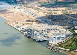
As you may already be able to guess, there are a number of sectors and projects that can gain great benefit from a professional bathymetric survey. Complex plants, mines and quarries, oil and gas projects just to name a few. While the specific benefits may vary with the type of work and the industry, there are several commonplace benefits of a bathymetric survey that will be of importance to most projects. These are:
The cost of a bathymetric survey depends on several factors: the size and depth of the area to be surveyed, the method used (single-beam surveys are typically more cost-effective than multi-beam for smaller sites), site accessibility, and the level of detail required for your project. Harbour and port surveys covering larger areas, or those requiring sub-bottom profiling, will generally cost more than a straightforward single-beam survey of a small waterway.
With more than four decades of surveying experience in over sixty countries, the Merrett Survey team have the technical expertise and knowledge to conduct a bathymetric survey for your next project. If you are interested in receiving a free quote, or would like to learn more about our topographic survey services, then please contact us on 01392362161 or by email at info@merrettsurvey.com. One of our professionals would be happy to discuss your needs.
