
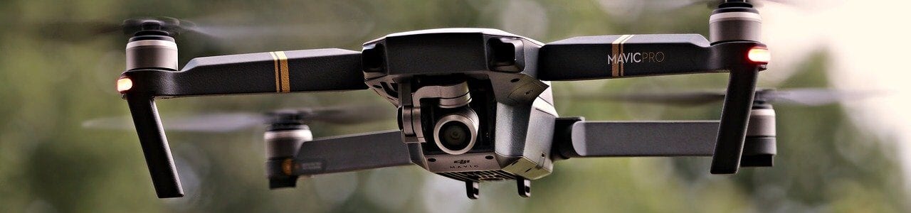
Everything You Need To Know About Drone Surveys
Lidar and Drone surveying are highly accurate methods that can effectively map all types of environment, across a wide variety of projects. Their impressive ability to capture highly-technical data is down to their intelligent downward-facing sensors and advanced GPS system, resulting in the capture of crucial aerial survey data. This can then be provided to engineers and architects for future planning.
The ability of the drone to capture highly-technical data, through their intelligent downward-facing sensors and advanced GPS system, enables the system to capture crucial data from aerial surveys that can then be provided to engineers and architects for future planning.
An important method of surveying, drones are impressive devices that provide many benefits, due to their enhanced speed and efficiency. This enables our experienced team to rapidly capture data and present to our clients within a quick turnaround.
What Is Drone Surveying?
Drone surveying is where an aircraft is loaded with high-resolution cameras and sensors, with the drone system combining robotics with aeronautics to maintain an elevated height.
What Is The Purpose Of Drone Surveying?
Drone surveys produce highly-detailed images and pieces of data that are passed on to architects, engineers and anyone else involved within the development of a section of land. With the land having been closely examined, this means that engineers are aware of any areas that need to be flagged, or pose risks to any further development plans.
Where Can Drone Surveying Take Place?
The great news is that drone surveys can be effective in pretty much any area, with dense forestry (which would be hard to gain access to on foot) and quarries (which can be potentially dangerous if examined on ground level) being two of the main sectors where drone surveying can be completed for maximum success. LiDAR sensors in drones collate this data, with precise 3D images taken of the areas, to map across a certain distance or metre squared.
What Are The Benefits of Drone Surveying?
From the quality of the data gathered to the reduced time involved in the completion of the project, there are many benefits to drone surveying, including:
Increased safety
As drone surveys are unmanned aerial vehicles, surveyors do not have to be at the specific site point that the drone is navigating above. This allows individuals and teams to access areas that have previously been thought to be inaccessible. These could be areas such as rooftops, utilities or the underside of a bridge.
With the reduced amount of contact between the site and surveyor, this increases overall safety levels. Due to hazardous sites posing potential risks to surveyors, these contact points can be avoided but with important data still gathered. It also means that you are not limited to just one environment, as with drone surveying you can more or less obtain information from anywhere in the world.
Cost-effectiveness
Drones can be much more economical than other surveying sources, with the overall cost reduction improving the efficiency of the supply chain. This means that we can limit the amount of other tools that require more human labour and budget, making drone surveying the perfect choice for clients who are looking to complete a project on time, without going over budget.
Quick Turnaround Time
The fast performance of the drone’s motors and propellers significantly impact the speed, with only the latest drone technology being used by our knowledgeable team at Merrett Survey. With drone surveying only requiring a shorter time frame to gather all relevant data over a wide area. Achieving impressive results quicker than other surveying methods, drone surveying is renowned for its unbeatable efficiency.
Compared to traditional surveying methods, which can be quite slow, drones enable surveyors to obtain crucial information quickly and efficiently.
Advanced Data
As the aircraft can obtain great distance, the data collected is of much higher quality and accuracy than a satellite or manned aircraft. The cameras found upon the drones can capture a multitude of HD images at varying angles, and at extreme quality. Our latest software developments enable us to merge the imagery and create coloured 3D terrain models, capturing detailed and varied pieces of data deliverables, such as 3D BIM models, point cloud data and orthophoto mosaics. As traditional land surveying can restrict the way in which data is presented, drone methods can bring into play a number of high-tech possibilities.
Did you know?
Data can generally be captured five times faster with drones, that it can be with land-based methods.
How Does Drone Surveying Present & Collect Data?
At Merrett Survey Ltd, our close-knitted team of surveyors work alongside our clients from the outset of the project, ensuring that we provide them with a high level of data that will allow for informed decisions to be made, but with other data too that can help expand their services.
Take a look at some of the main data deliverables we can present your data in:
Building Information Modelling (BIM Models)
Combining drone surveying with advanced photogrammetry software helps provide a 3D visual representation of the area of land or building area, otherwise known as a BIM survey…

Digital Terrain Models(DTM)
Drone images can be utilised to create accurate DTMs. These are accurate 3D representations of a terrain’s surface that is constructed from terrain elevation data.
Orthomosaic Maps
We can deliver detailed and high definition orthomosaic maps, merging the orthophotos to form a large, high resolution and map imagery of the surveyed area. Measurements, such as horizontal distances and surface areas, can also be included.
3D Point Cloud Data
We can create densified point clouds by providing detailed geospatial information where the points represent a 3d shape or object. These point clouds provide extremely accurate models for distance, area and volume measurements, plus visualisation in 3D.
Contour Lines
Through a DTM, contour lines which represent ground elevation or depression can be mapped. These contour lines provide a greater understanding of the surface areas captured by the drone.
Inspection Work
Remotely accessing structures, such as transmission line towers, communication towers, bridges, chimneys, piers and high walls. Therefore, we can obtain detailed imagery which can then be used to assess the condition of an asset.
The Limitations
Whilst the endless list of benefits significantly outweighs the limitations of surveying, there are also some small limitations to drone surveying. Many companies will not be keen or aware of mentioning these, however, as professional land surveyors who are fully trained in conducting drone surveys, we will always be transparent and open with advice to our clients.
“High accuracy is possible, but you will need some ground control and a high quality camera, plus ‘real time’ GPS installed on the drone. Note – you can approximate vertical accuracy at about three times the pixel size. There will be areas where access permissions for flying are very hard to achieve.”
Drone Surveying From Merrett Survey – Contact Our Team Today
As an established team of drone surveyors and pilots, we look forward to assisting in the development and planning of your next project. With the ability to provide our drone survey services across a variety of sectors, we will always advise you on the best course of action.
Please book your free initial consultation to receive your free UAV survey quote by contacting us. Call us on 01392 362161 or send an email to info@merrettsurvey.com. We look forward to working with you.

Peter Merrett - Owner & CEO
Get in Touch


