
Merrett Survey Recognised for Nigeria – Cameroon Border Survey Work
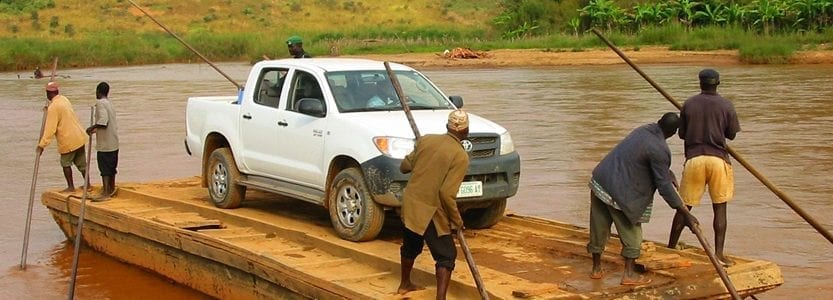
Merrett Survey is proud to have featured in ‘Ground Truth’, an article written by Jen Banbury and published by Atlas Obscura. We’ve featured in the article and gained recognition, following boundary surveying work carried out on the border between Nigeria and Cameroon. Our border survey contribution, which was carried out in 2007, helped both countries to define their common border, which was a requirement of an International Court ruling.
Border Survey from Merrett Survey
We have been providing boundary and border survey services for decades, travelling to some of the remotest places on earth to help define and develop borders. Our team of professional surveyors utilised the most effective surveying techniques throughout previous projects and continue to implement the latest technologies. Today, we still provide land boundary surveys that help resolve issues. In the case of the Nigeria and Cameroon border, we provided the high accuracy survey control that was required to help the two countries define the border. In the case of Cameroon, our control network was more accurate than anything the country had at the time.

A Background to the Nigeria – Cameroon Border Issue
The dispute has a history dating back to around 1910 but in 1981 things intensified. Nigeria and Cameroon were locked in a dispute over part of their 1,300 miles land boundary, which stretched from Lake Chad to the Bakassi Peninsula. The dispute centered around which country had rights to the Bakassi Peninsula – of particular interest to both countries due to its natural gas and oil reserves.
- In 1993, the friction reached new levels as Nigeria turned to having a military presence at the Bakassi Peninsula and armed clashes ensued.
- It wasn’t until 2002 that a court ruled that the land was the property of Cameroon, and the court ruling stated that they must fully agree and record the rest of the boundary so as to prevent future disputes.
- In 2006, the Greentree Agreement was signed and a committee was set up to ensure the agreement was implemented with integrity.
Excerpts from Ground Truth
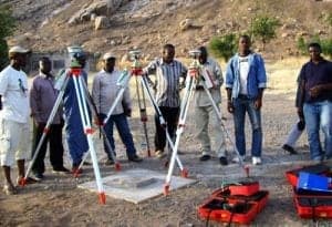
In ‘Ground Truth’, the boundary survey work that Merrett Survey carried out and the precision required is detailed. Also touched upon is how we trained Cameroonian and Nigerian boundary surveyors in the application of high accuracy GPS for boundary demarcation work.
An Overview of the Work Carried Out
“In 2005, Merrett Survey put in a bid with the United Nations to work on the Nigeria-Cameroon border and it was accepted.
“Before true delimitation can be done, you need to establish a network of highly accurate geodetic control points, known as survey stations, whose coordinates are so precise that they then can act as the primary fixed points from which all other measurements are made.
“Merrett and his team were tasked with installing 10 primary stations (five in each country) and 20 secondary stations (10 in each country), which could be between about six and 40 miles from the border. They began their work in 2007. Four surveyors from Merrett also trained Cameroonian and Nigerian surveyors in their methods, as part of the contract with the CNMC (Cameroon Nigeria Mixed Commission).
The Significance of Precision & Accuracy Control
“Obtaining that accuracy isn’t easy when a company such as Merrett Survey takes on a job, the level of precision is specified by contract. The CNMC contract stipulated that the coordinates of the survey stations must be precise to within 50 millimeters, or less than two inches. The more accurate and precise the control point, the more accurate and precise the border coordinates.
“The margin of error between Cameroon and Nigeria, more or less, was the length of your thumb. Merrett’s control points were used to ramp the precision ever higher. So it took history, law, diplomacy, and linguistic decoding to find a spot and then science and engineering to fix it in the world.”
You can read the full article by visiting Atlas Obscura – Cameroon and Nigeria Border Dispute.
Boundary Surveying Across Continents
The Cameroon – Nigeria border survey work was of great interest to the Merrett Survey team, and a project that we enjoyed applying our expertise to. We’ve also carried out border surveys between Israel – Lebanon and Mozambique & Malawi, among several others. Most recently, we have recently received a small extension of an international boundary survey that we carried out in Kuwait.
Peter Merrett has been a tutor at two workshops organised by the IBRU, ( International Boundary Research Unit ), which is part of Durham University tutoring on the practical field aspects and the geodetic considerations of international boundary demarcation.
Contact us if you wish to learn more about our international boundary survey and demarcation work on the Cameroon – Nigeria border, or border survey work carried out in any other location internationally.

Peter Merrett - Owner & CEO
Get in Touch


